ABOUT US
"The highest education is that which does not merely give us information but that makes our life in harmony with all existence"
-Gurudev Rabindranth Tagore
We at AGSRT take the meaning of these words to heart and strive to impart the envisioned education for all in the field of GIS.
We provide Geospatial expertise in the form of solutions and training. Founded by a group of experts who started by scribbling their ideas on a piece of paper, today we offer smart, innovative services to dozens of clients worldwide.
We built our solutions by closely listening to our potential clientele and understanding their expectations with our product. We know how to analyze this information and customize our offering to changing market needs. Why not join our fast-growing customer base? Get in touch today to learn more about the AGSRT story.

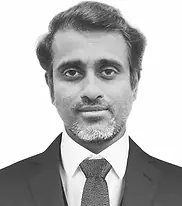
Midhun S
Founder, Proprietor & GIS Specialist
Midhun is the founder of AvakAza Geo-Science Research & Technologies with a decade of successful experience in the GIS Industry as an Analyst, Developer, Business Development Manager, and expert trainer who had trained more than 500 freshers and professionals all over the world.
He got hands-on experience working with ArcGIS, ArcGIS for Server, ArcGIS Online, JavaScript API, Leaflet API, Geoserver, QGIS, PostgreSQL with PostGIS extension. Midhun has worked with reputable MNC companies, including First Indian Corporation(Currently Cognizant Technology Solutions), SLK Global Solutions, and Fidelity National Financial among others.

Vijay, has joined us as Business Head & HR - Corporate Service. He comes with almost 21 Yrs of Experience in the field of Operation Management, Client Acquisition, HR & Recruitment, and also with the experience of working with 3 Startups.
He has worked in India and Abroad and has started from the Executive level to the Management positions. He has developed processes to improve the efficiency, Revenue and Turn over. Have developed a huge network of colleges and training centers, which in turn helps the development of better recruitment and Training Source. He also has worked with various clients and brought major projects which has improved the revenue of the companies that he has worked.
Vijay V
Business Head & HR - Corporate Services

Sanjay S Kumar
Business Development Executive
Sanjay has been working with AGSRT for last 1.5 Yrs and instrumental in building College Network and spreading the importance of GIS. He has worked with Colleges and got MOU partnership signed for colleges in Kerala and Tamil Nadu. He has a background of GIS and Marketing
Faculty & Training Team

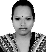
Anusuya Manickkam
GIS - Project And Training Manager
An avid GIS Expert with 7 years of experience in ESRI – ArcGIS Products, training and project management for fields like Transportation, Utilities and mapping of ecological and environmental restoration. Dedicated to maintain strict compliance with quality standards and business goals. Contributes to vital projects, providing valuable GIS solutions and services with holistic approach.
Primary Skills - ArcGIS Pro, ArcGIS Desktop, WebApp Builder, ESRI Field Apps - Survey 123, Collector, ArcGIS Online, ArcSDE, QGIS, Google Earth Engine

A GIS enthusiast who also possesses a Master's degree in Applied Geology. Gokul has over 8 years of professional experience. Worked for different firms on various projects ranging from GIS and navigation to geology, geophysics, mining, oil and gas, and so on.
He is enthusiastic about GIS, remote sensing, geoscience, and hydrogeology. Working knowledge of ArcGIS, ArcGIS Pro, ArcGIS Online, QGIS, MapInfo, Global Mapper, MS Office suite, and basic Python and SQL. Currently, he has chosen the career of a GIS Trainer in order to share his experience with every GIS aspirant and to reach the greatest number of people with GIS concepts.
Primary Skills - ArcGIS Desktop, QGIS, Google Earth Engine, MapInfo, Global Mapper, ArcGIS Pro, ArcGIS Online, MS Office Suite, Basic Python and SQL
Gokul GK
Sr. GIS Trainer

Clara Stani
GIS Trainer
Geology Graduate with great passion in Geospatial Technology. Dedicated and hardworking person with one year of experience working with ArcGIS software, QGIS and MicroStation Vi8 software for developing GIS databases, data creation and snapping tolerances. Critical thinker continuously looking at ways to improve processes and build career as GIS expert. Excel in editing, map production and creating vector & raster maps. Aim is to integrate GIS and Remote sensing using Data Science for bright future.
Primary Skills - ArcGIS, Data Conversion, Data Management, Python, Machine Language, Data Visualization, Analytical Thinking, Mapping, Image Classification (Vector And Raster), 3D And 2D Analysis , MySQL.

A research enthusiast, having 6+ years of academic experience in the field of Geology (hydrogeology). Skilled at geospatial, statistical data analysis along with writing scientific articles and publications. Passionate about RS and GIS technology, committed to continuous learning and professional development with a genuine interest in improving environmental quality.
Primary Skills - ArcGIS desktop, QGIS, Google Earth Engine
Dr. Ankita Chatterjee
GIS Trainer & Research Team

Varsha
GIS Trainer
Varsha, a research fanatic who has completed her Masters (M.tech) in Remote sensing and GIS from National institute of technology Karnataka (NITK), Surathkal and Bachelors (BE) in Civil engineering from SDMIT, Ujire. She is recognized for her communication and presentation skills. She has attended national conferences and has also been awarded for the research works. Her researches are mainly on applications of remote sensing and GIS in environmental studies. She was an intern at Indian National Centre for Ocean Information services (INCOIS), Hyderabad on “OPEN SOURCE (OS) RS-GIS SOFTWARE (QGIS)”. ArcGIS, QGIS, BRAT, ERDAS IMAGINE, Google earth, AutoCAD and Microsoft office are some of the softwares she has worked on and has knowledge about. She has also handled training sessions on Remote sensing, ArcGIS and QGIS.
Primary Skills - ArcGIS, QGIS, ERDAS IMAGINE, BRAT, Google Earth

Professional programmer and trainer, having more than 12 years of experience in the field of teaching and trained more than 2000 students. She has handled training on programming concepts as well as GUI applications, they include C, C++, Java, Php, SQL, Web Development, Auto cad, and ArcGIS.
Projects Handled
NDLM, MORD
Programming Skills
C, C++, Java, Python, Php, SQL, HTML, CSS, JavaScript, Node Js, Angular Js, Arcpy, , GUI Application, ArcGIS, Auto CAD.
Primary Skills - ArcGIS desktop, QGIS, Google Earth Engine
Roselynn
Trainer - GIS Programming & Application Development

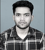
Ajmal
GIS Developer
Ajmal S is a highly skilled GIS Engineer with a strong background in Geo-Technology and Geo-Informatics. With an Integrated MTech degree in Geological Technology & Geo-Informatics from Bharathidasan University, Ajmal brings expertise in spatial analysis, mapping, and developing GIS products to drive innovative solutions and optimize decision-making processes. Ajmal gained valuable experience as a Project Intern at the National Institute of Disaster Management (NIDM) in New Delhi, India. During this internship, Ajmal actively participated in disaster management projects, utilizing his expertise in GIS to support data analysis and decision-making. Ajmal has also served as a Summer Intern at the Indian Institute of Remote Sensing (IIRS) in Dehradun, India, where he gained hands-on experience in remote sensing, digital image processing, and geospatial data analysis. With proficiency in ArcGIS, QGIS, ENVI, Erdas, ESA-SNAP, and other GIS tools, Ajmal possesses a comprehensive skill set to handle diverse geospatial projects. Additionally, Ajmal has experience with programming language such as R and Python, allowing him to develop customized solutions and leverage machine learning techniques for spatial data analysis.Primary Skills: ArcGIS Products, QGIS, ENVI, ERDAS IMAGINE, Geosoft Oasis Montaj, Python-Arcpy, Google Earth Engine, ESA-SNAP, SARPROZ, SAR Data Processing
Primary Skills - ArcGIS, QGIS, ERDAS IMAGINE, BRAT, Google Earth

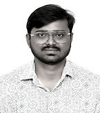
Having completed a postgraduate degree in Geoinformatics from JSS University of Higher Education and Research, motivated and result-driven professional in the field of Geospatial technology. With extensive involvement in significant projects like the Cheetah project and Mangalore Smart City project, acquired invaluable experience in GIS. Proficient in using Office 365, various GIS-related software such as ArcGIS Desktop, ArcGIS Pro, Erdas Imagine, QGIS, Google Earth Pro and others. Passion for continuous learning motivates him to pursuit excellence, shaping him into a dedicated and knowledgeable individual.
Primary Skill - ArcGIS Desktop, ArcGIS Pro, ArcGIS Online, Python, C Programming
Google Earth Engine, Database Management, SQL, QGIS, Erdas Imagine, Openstreet map, Kepler.gl, Mapbox, Survey 123
Shrikrishna Kukkemane
GIS Analyst & Trainer

Amaresh
Software Developer
Amaresh is a skilled python developer who has expertise in creating Artificial Intelligence, Machine learning and deep learning solutions. He has contributed to the development of AIs for healthcare and built various predictive models. He has also conducted some research projects and obtained impressive outcomes. He has been working with python for over five years and is proficient in databases as well. He is also familiar with Java, C++, R, Ruby programming languages. He has recently joined our organisation as a member of the Research and development team, where he will work on developing innovative products.