
.png)

GeoAI-Driven Building and Road Extraction
AI-powered mapping of buildings and roads from high-resolution imagery in ArcGIS Pro.
GeoAI, in ArcGIS Pro and deep learning to automatically extract buildings and roads from high-resolution imagery. We deliver accurate, GIS-ready outputs that support urban planning, infrastructure mapping, and spatial analysis with speed and precision.
Cadastral Boundary Extraction
Using scanned cadastral maps as input, deep learning models are trained to detect plot boundaries automatically. This approach enables:
-
Precise boundary extraction from non-standardized, legacy maps.
-
Significant reduction in processing time compared to manual digitization.
-
Scalable feature extraction for municipalities, districts, or entire regions.


Road Network Extraction
Road features are extracted from satellite imagery with spatial resolution of less than 80 cm. This solution enables:
-
Detection of road alignments including major and minor roads.
-
Vector-ready outputs for integration into transport and planning systems.
-
Suitable for rural and urban transport network mapping.
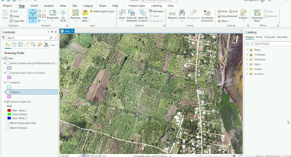
Palm tree extraction
-
To map and monitor palm tree distribution for plantation management, inventory assessment, and environmental analysis.
-
Demonstrated the integration of AI-driven deep learning techniques with GIS workflows for precise vegetation feature extraction.
-
Used 1-meter resolution satellite imagery to ensure accurate detection of individual palm trees.
-
Prepared training samples (chips) representing palm tree and non-palm areas.
-
Trained a deep learning model using the training data in ArcGIS Pro.
Why Choose Our GeoAI Solutions
We combine GIS expertise with AI-driven automation to deliver accurate and scalable mapping solutions. Our team ensures every output meets industry standards for precision and usability. Whether you need large-scale urban mapping or localized infrastructure extraction, our GeoAI workflows in ArcGIS Pro provide consistent, high-quality results. Partner with us to streamline your geospatial analysis and make data-driven decisions faster.